

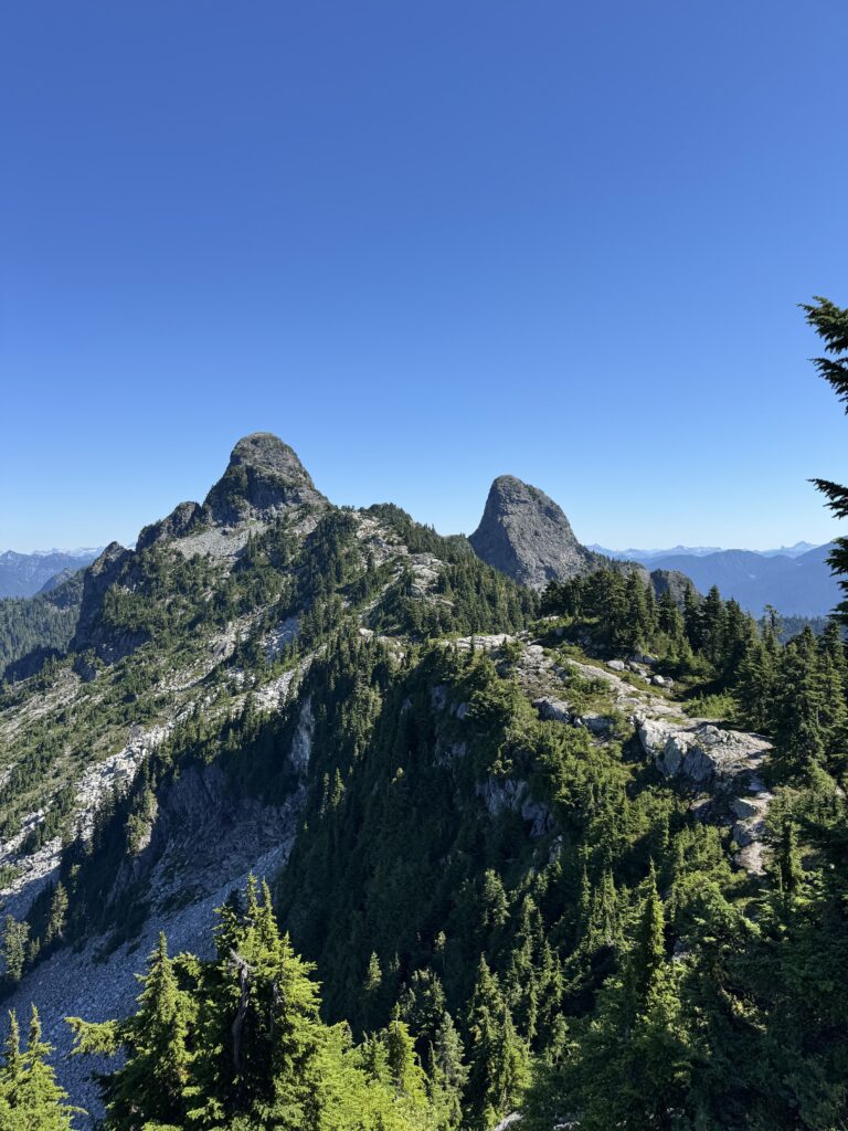
The West Lions Mountain (also known as Twin Sisters) is a mountain towering north of Vancouver.
Since I’m hiking in Vancouver area, I absolutely want to conquer the Lion at least once! This year, I made up my mind, trained starting in spring, and challenged during the long days of midsummer!
In this blog, I ‘ll share my experiences hiking The West Lion Mountain !
Origin of the name – The Twin Sisters
Before we get into the hiking, according to a legend of the Squamish native people, Canada’s indigenous inhabitants, the mountain two peaks are actually twin sisters, not Lion’s two horns.
The Twin Sisters are a symbol of peace between the Squamish and the Haida.
In this blog post, we will henceforth refer to them as the Lions.
The West Lions hike – Difficulty
This is an extremely steep and technical trail.
The initial section involves walking along a long gravel path, which eventually transitions into a mountain trail and then an ascent over rocky terrain.
Preparation
Considering the difficulty, only climbers with appropriate equipment and experience should attempt this hiking.
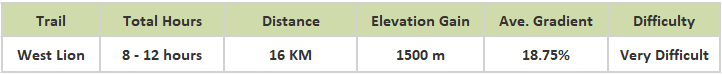
Information indicates a 16 km round trip to the summit with an elevation gain of 1525 m, making it a very long journey.
Estimated time: 7 to 12 hours…..including a rest at the summit, my climb took 10 hours.
I carried 2.5 liters of water. (The climb was in August, mid summer.)
I wanted to carry more….., but the weight was my limit…..can not add any more.
The West Lion mountain trail
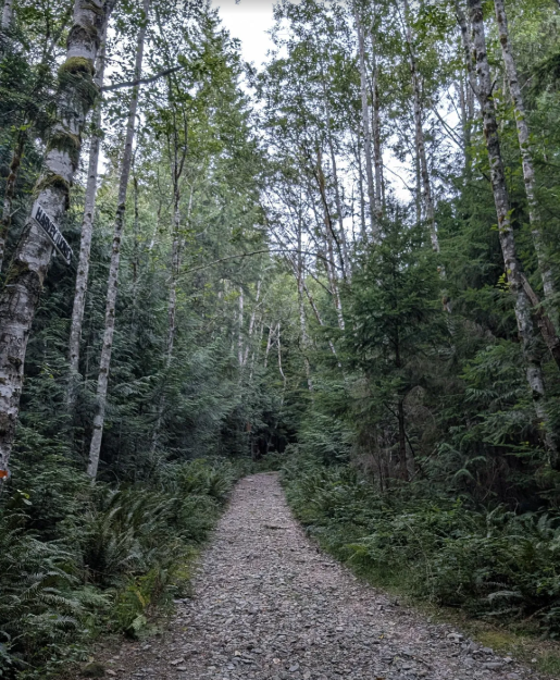
Gravel Service Road
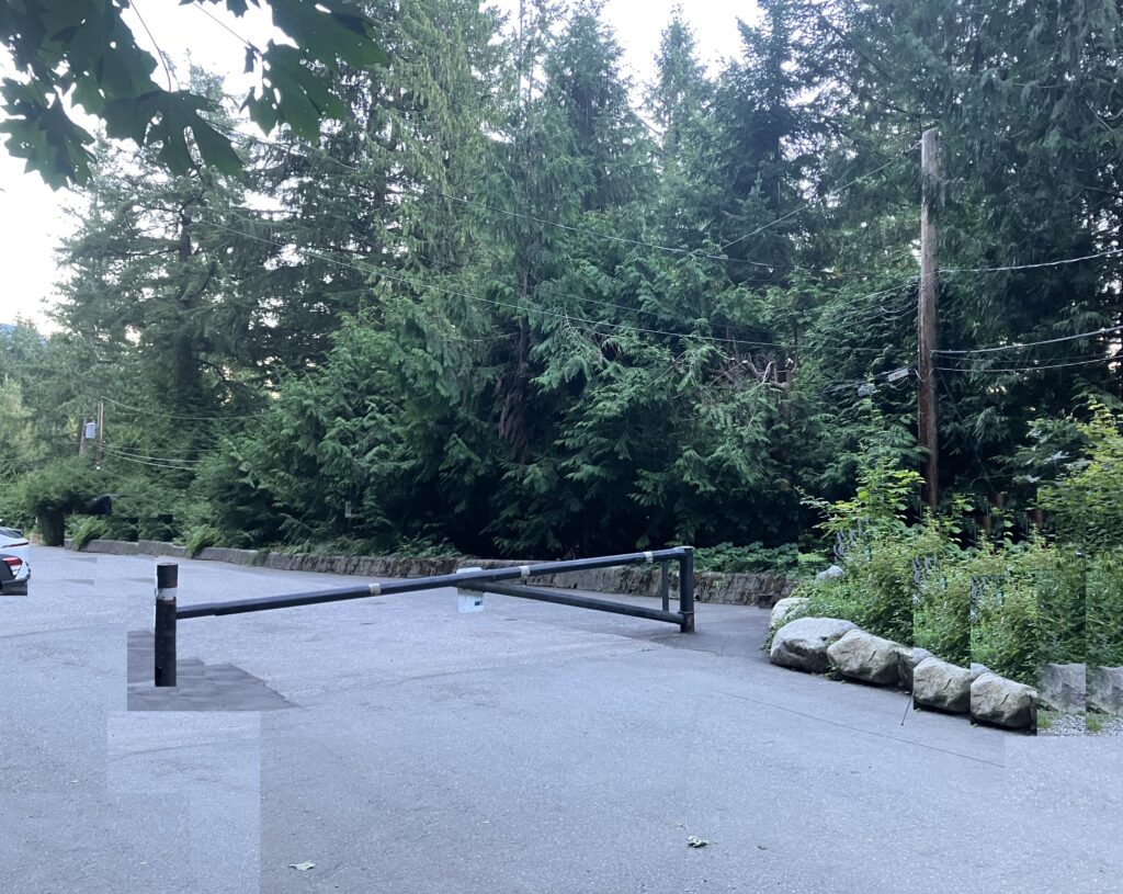
Starting from the yellow gate at Lions Bay, the trail begins on a wide, flat gravel path before starting to climb. It gradually transitions into an ascent.
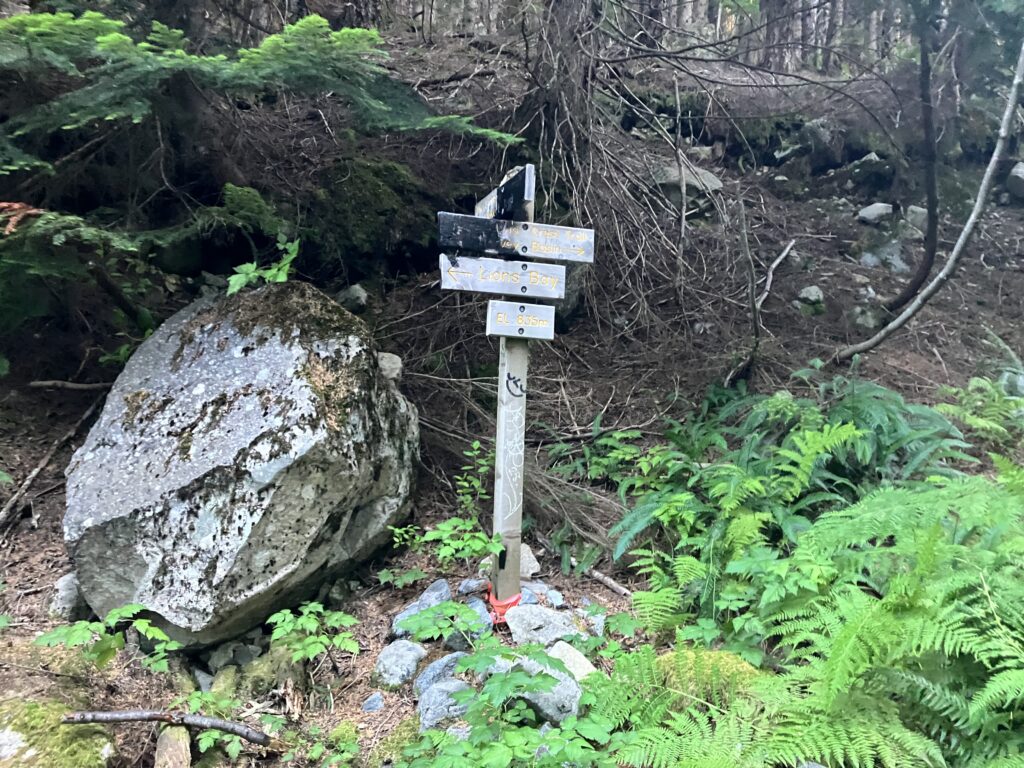
Sign at junction of The Lions
After climbing a short distance, you’ll reach a junction in the path. At the junction, continue straight ahead to the right.
After walking for about 25 to 30 minutes, you’ll reach another junction. Here too, continue straight ahead to the right, climbing the slope as the path begins to level out.
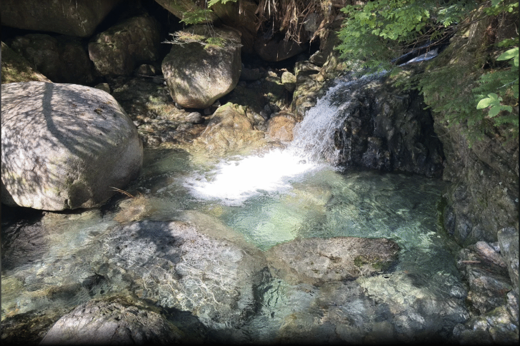
Climbing the mountain road
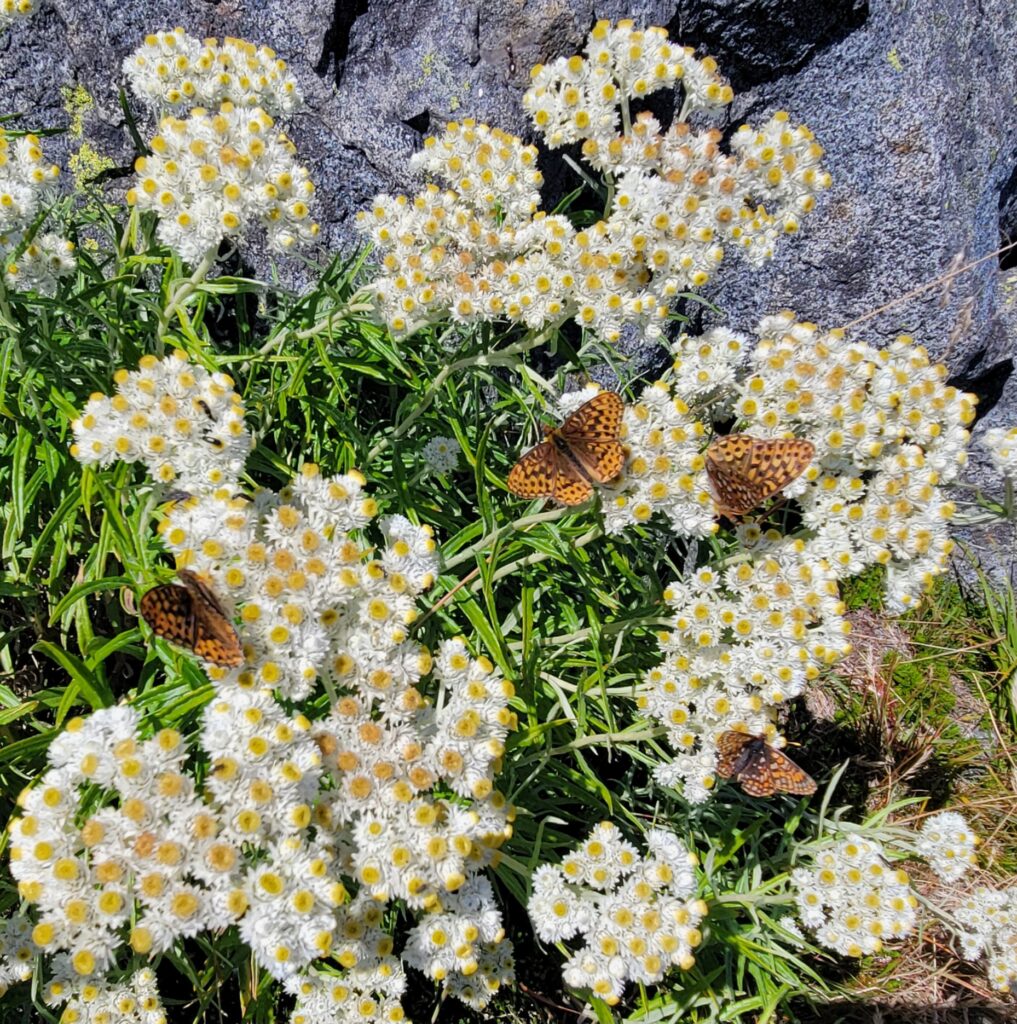
The road winds around the mountainside, passing several picturesque waterfalls.
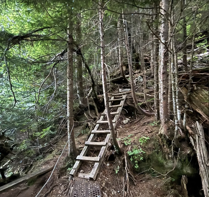
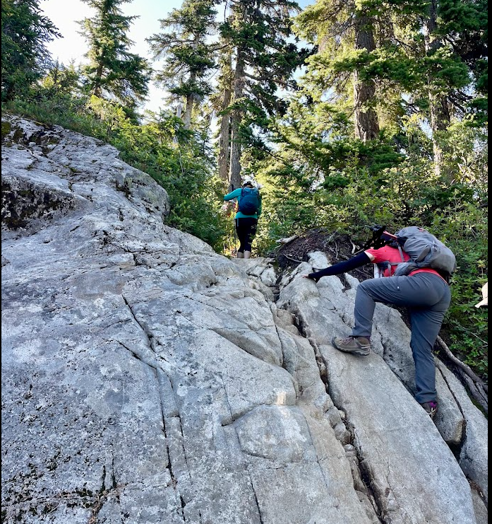
After crossing the creek, the trail gets interesting and is steep.
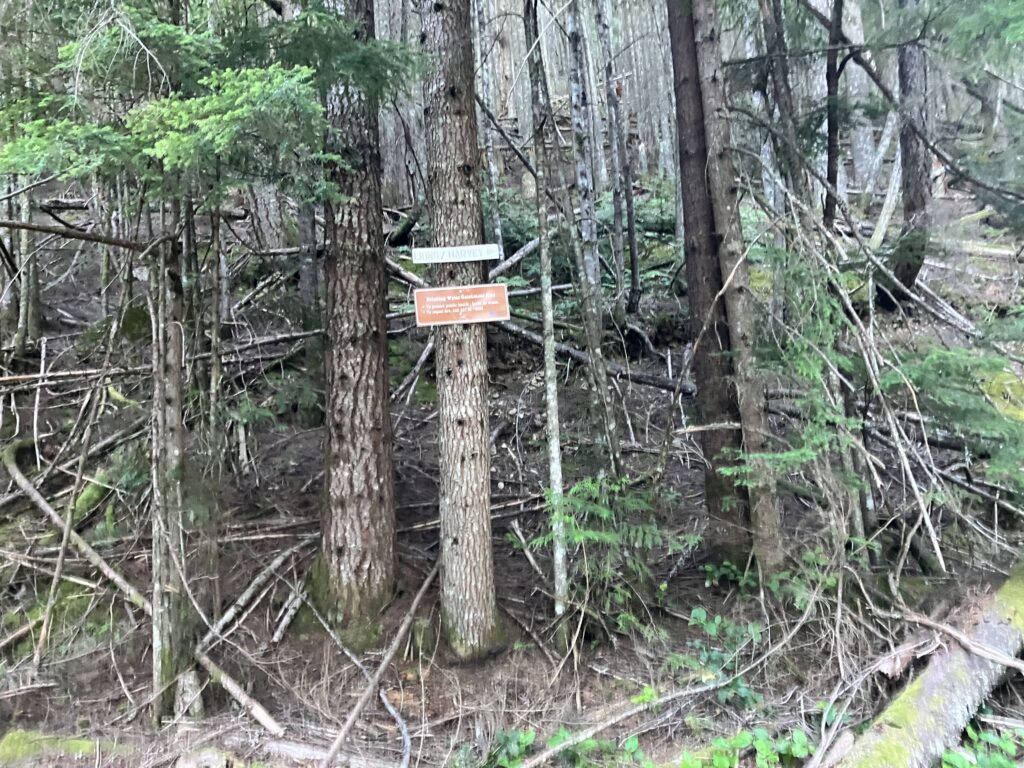
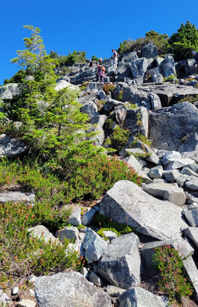
As the road gradually becomes rockier, watch for the Lions signs.
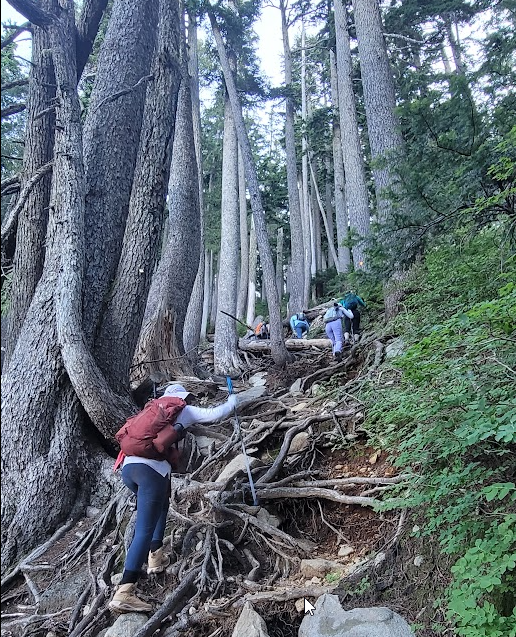
Climbing over stones and tress
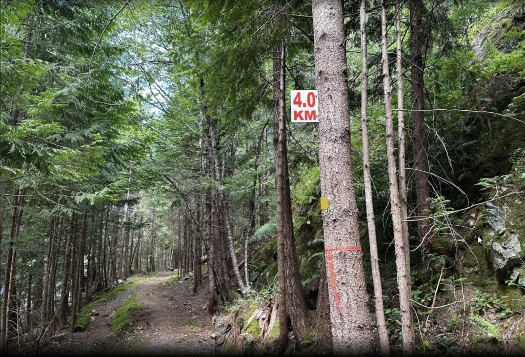
For the next hour or so, the trail continues climbing through forests of Douglas fir and western red cedar.
The climbing shifts from mountain trail to rocky terrain.
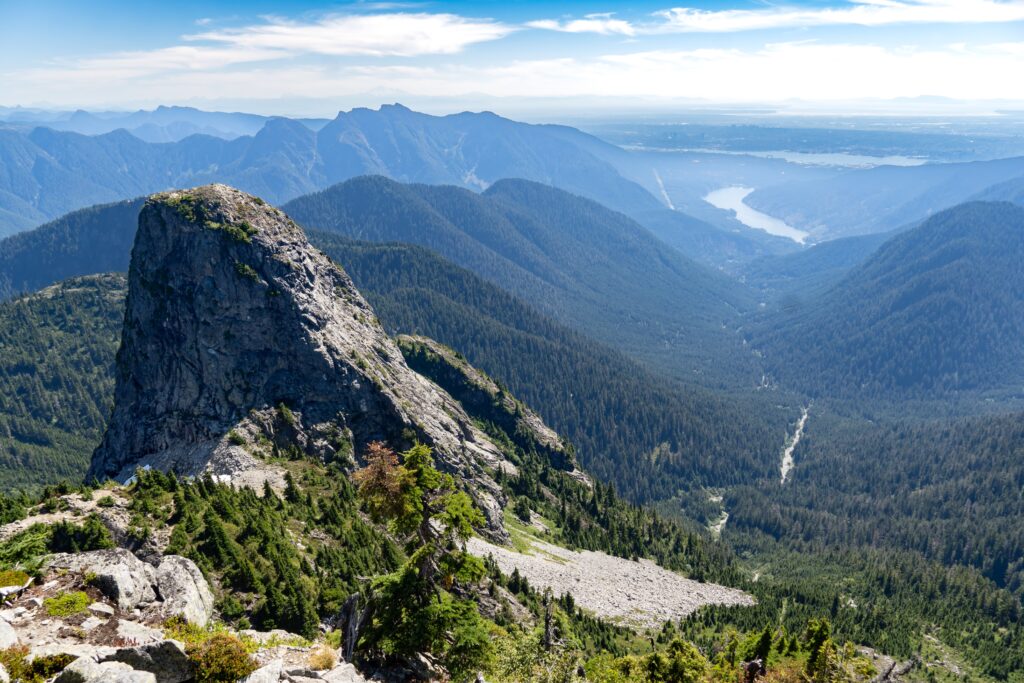
You can see that traces of rockfalls that occurred over thousands of years….
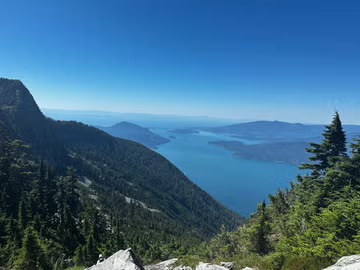
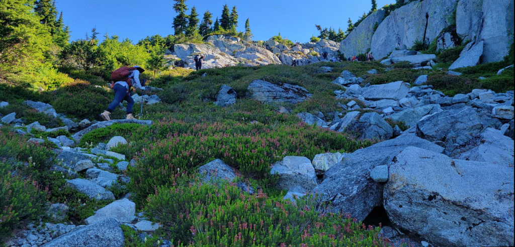
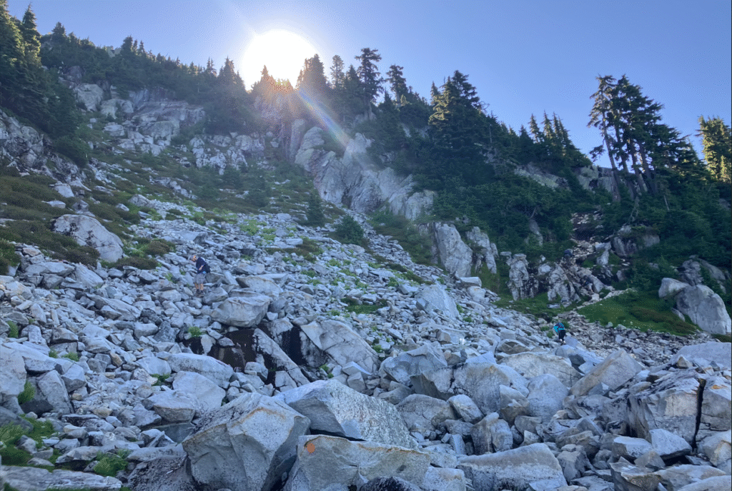
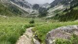
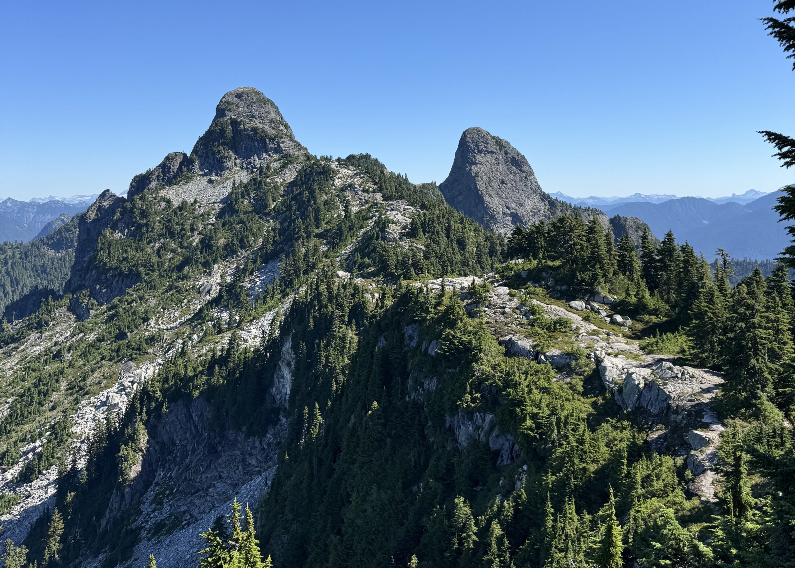
Eventually, the path emerges through gaps in the trees onto the ridge, revealing the breathtaking view of The West Lions towering to the right.
An even more spectacular views, keep climbing higher ridge.
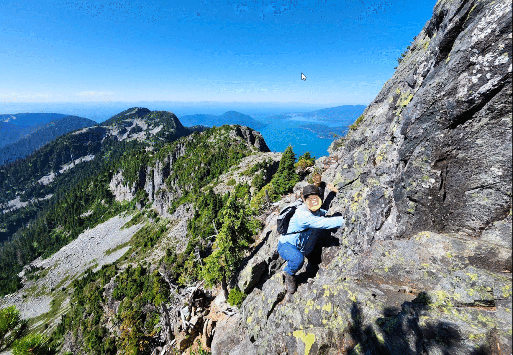
Climbing the rock
As the terrain gradually shifts from the trail to large rock formations, follow the orange markers.
As you continue climbing, pause occasionally to look back and take in the view of How Bay and Lions Bay, where you began your trek that day.
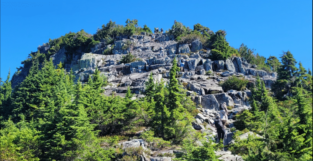
The route over the giant rock continues climbing, the slope growing steeper with every step.
The final section of the trail is the steepest, scrambling up a short valley toward the summit.
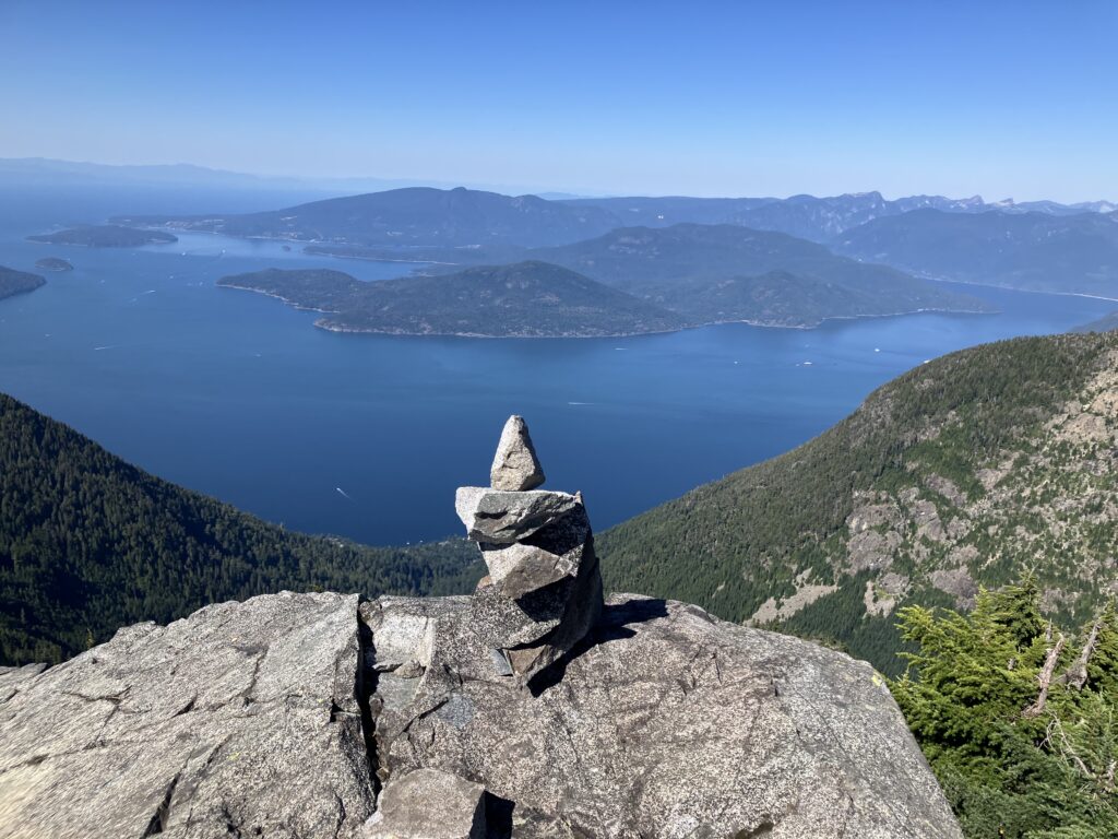
The West Lions Mountain summit
The route over the giant rocks, continues climbing, the slope growing steeper with every step.
The final section of the trail is the steepest, scrambling up a short ravine to reach the summit!
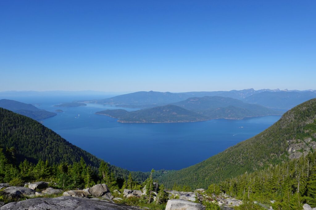
You’ll take in views of both peaks of Lions Peak, of course, along with Howe Sound to your left, Unnecessary Mountain and Vancouver.
The West Lions the final summit scramble
The final summit push is the most challenging part of the climb, requiring physical , mental strength, and experience — it’s optional for mountaineers.
Rescue teams are dispatched annually, with injuries and fatalities occurring every year.
One misstep on the rocky outcrop could send you tumbling to the valley floor.
Even when we were there on site, on-site, several climbers who had planned to attempt the summit and had already ascended to the mountain top gave up when faced with the summit itself.
Reaching the final summit requires both physical strength and intense mental focus, making it the most challenging part of the climb.
Even experienced mountaineers should carefully consider whether to attempt the summit.
Me ? I was waiting for my hikers mates to climb this scramble.
Even reaching the summit at the base of this peak is a big challenge, and an accomplishment for me!!
Head Down The West Lion
After take lunch, photos, and a short break, it’s time to head down to Lions Bay.
Carefully make your way down the rocky slope, keeping an eye out for the orange trail markers that show the path you climbed.
If you miss them due to fatigue, you might end up on a different mountain, potentially extending your journey.
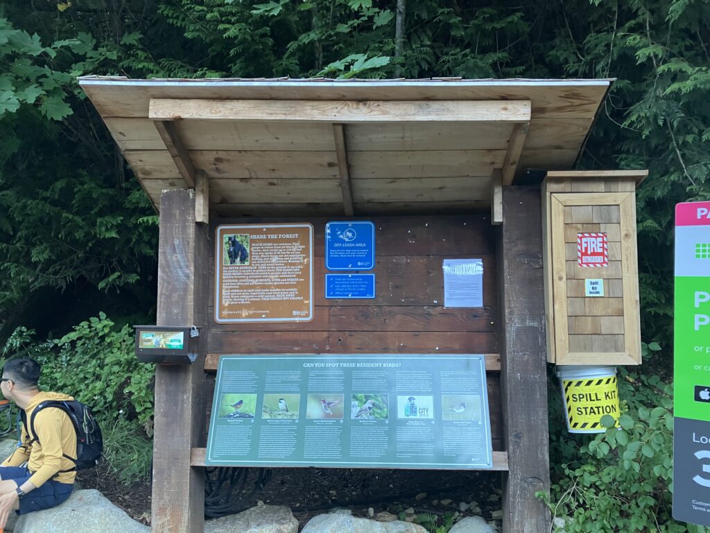
Access to the hiking trail
There are two routes for climbing Lions Mountain.
One is – parking at Cypress Mountain Ski Resort and start hiking.
The other is – parking at Lions Bay and hiking from there.
This time, we took the 2nd route, from Lions Bay.
For the Lions Bay route, you need to be lucky enough to find a spot in the limited public parking along the trail (usually full by 8:00 AM in summer).
Alternatively, there is temporary parking at the nearby Lions Bay Primary School.
Please note this requires an additional 2 km return of walking up and down.
The West Lions Mountain Hiking
On clear days, it can be seen from across the entire Metro Vancouver area.
For mountaineers, conquering its summit is one of the advanced climbs they aim to achieve.
The West Lions Mountain hiking should only be attempted by experienced hikers!
I started the ascent at 7 a.m. and spent 10 hours until head back to trail head.
After drinking all 2.5 liters of water I brought and returning home, I weighed 3 kilograms less. A total of 5.5 kilograms vanished as sweat.
I ended this summer feeling of accomplishment. and…… with a body full of muscle soreness.
Big thanks for this hike organizer and friends.
If you’re a climber, and staying in Vancouver, I highly recommend giving it a try!!
Reference All Trails Vancouver Trails Outdoor Vancouver

コメント